Households
- Know the local hazards and safe evacuation routes.
- Keep emergency contacts, documents and essential supplies accessible.
- Agree a family meeting point and communication plan.
- Follow official warnings from the responsible authority.
Disaster risk • resilience • preparedness
BRB / Professional ArchiveUnderstanding hazards, exposure, vulnerability and resilience to support better disaster risk reduction and climate-resilient action.
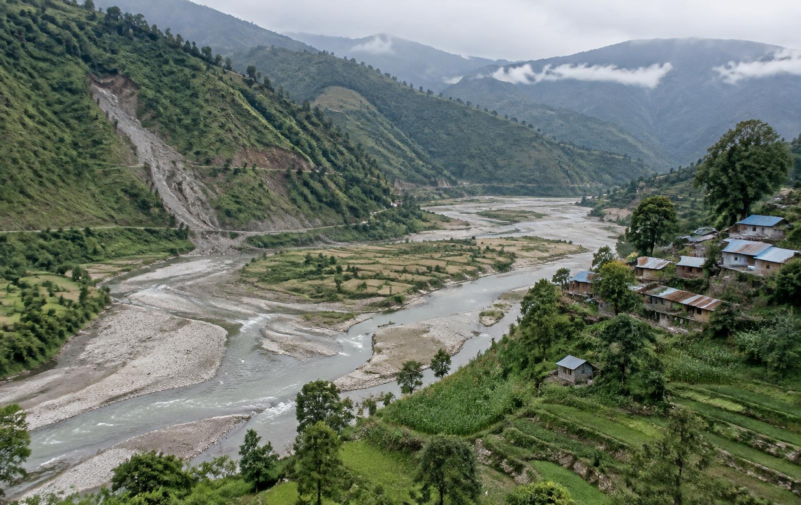
Replaceable demo photograph — a river valley showing floodplain, slope and settlement exposure together.
Foundations
A hazard only becomes a disaster when it meets people, homes, infrastructure or ecosystems that are exposed and vulnerable to it. Disaster risk therefore describes a relationship, not an event: the same rainfall can pass unnoticed in one valley and displace families in another, depending on where settlements sit, how they are built and what capacity exists to anticipate and respond.
Risk is not fixed. It changes with land use, road construction, river management, settlement growth, ecosystem condition, preparedness and climate variability — which is why risk information has to be kept current and read at a local scale.
No national statistics are shown on this page unless they come from a configured, verified source with its publication date and data period. Where a dataset has not been added, the page states that rather than estimating a figure.
Hazard overview
Hazard profiles describe the nature of each hazard and the factors that shape risk. They do not rank locations or assign risk scores.
Geography
Province boundaries and reference locations. Hazard layers appear here only when a verified geographic dataset has been connected.
Risk components
A potentially damaging physical event or process — a flood, a landslide, ground shaking, a dry spell or a period of extreme heat.
The people, homes, infrastructure, farmland, ecosystems and livelihoods located where a hazard can occur.
The physical, social, economic and environmental conditions that make exposed people and assets more susceptible to harm.
The knowledge, institutions, preparedness, resources and ecosystems that help communities anticipate, withstand and recover.
Historical record
Only verified, sourced events are listed. No event is reconstructed or estimated.
Province explorer
Verified information for Koshi is not yet available from the configured source. No overall risk score is assigned to any province.
Hazards with recorded events. No recorded events yet from the configured sources.
Historical records in the database. None available yet
Risk datasets available. No geographic risk dataset is connected yet.
No overall risk score or ranking is assigned to any province.
Hazard in focus
River flooding, flash floods and urban flooding affect different places in different ways. River flooding builds over hours to days along major channels; flash floods arrive with little notice in steep catchments; urban flooding follows intense rainfall where drainage and permeable ground are limited.
Exposure grows when settlements, roads and farmland occupy floodplains and river margins, and when embankments shift risk downstream. Reducing flood risk combines early warning and evacuation planning with floodplain management, drainage maintenance, resilient construction and nature-based measures that give rivers space.
Hazard in focus
Most landslides in Nepal's hills are triggered by intense or prolonged rainfall acting on slopes whose stability already depends on geology, soil depth, groundwater and vegetation. Human activity changes that balance: slope cutting for roads and buildings, altered drainage, terracing practices and land-use change can each shift a marginally stable slope toward failure. Exposure is concentrated where settlements, roads and lifeline infrastructure sit below or on unstable terrain. Mapping susceptibility, monitoring rainfall thresholds, managing drainage and using bioengineering alongside careful siting are the practical levers.
Landslide susceptibility mapping is shown only when a verified dataset is connected; no susceptibility areas are drawn from assumption.
Hazard in focus
Nepal sits in a seismically active region, and earthquake risk is shaped far more by what is built and where than by any location being inherently safe. Building type and construction quality, dense urban settlement, narrow access routes, lifeline infrastructure and the readiness of institutions and households together determine the consequences of ground shaking. Preparedness works through seismic-resistant construction and retrofitting, open-space and evacuation planning, emergency drills, reliable communication and community awareness. No place in Nepal should be described as free of earthquake risk.
Connection
Climate variability and climate change can influence some hazards and exposure patterns. They do not cause every individual disaster, and each relationship below is a tendency, not an attribution of a specific event.
Anticipation
Risk information
Forecast and warning
Anticipatory action
Preparedness
Response
Recovery and resilience
An early warning system only reduces loss when the warning reaches the right people, is understood, and is matched with an action they can take in the time available. That means clear roles for forecasters, authorities and communities, agreed triggers, and resources released before impact rather than after.
Forecast-based and anticipatory action turn a credible forecast into pre-agreed measures — moving livestock and assets, reinforcing critical points, distributing support early — coordinated between local government, humanitarian partners and the communities themselves.
Ecosystems
Well-managed ecosystems can reduce hazard intensity and exposure while supporting livelihoods — most effectively alongside, not instead of, structural and institutional measures.
Action
Current information
This page does not generate warnings. It lists entries published from configured official sources, each labelled by what it is.
Official weather and hydrological warnings for Nepal are published by the Department of Hydrology and Meteorology; national disaster information by NDRRMA and the BIPAD portal. Always verify an alert with the issuing authority.
Data
These counts describe what has been verified and published on this page. They are not national disaster statistics.
Professional work
No published research or project records related to disaster risk are available yet.
Transparency
No sources are configured yet.
A hazard is a potentially damaging event or process. Disaster risk describes the potential loss that arises when a hazard interacts with exposed people or assets and with the conditions that make them vulnerable, set against their capacity to cope.
No. A forecast describes expected weather. An official warning is issued by the responsible authority. Forecast information on this website is never converted into a disaster warning.
Weather and hydrological warnings come from the Department of Hydrology and Meteorology, and national disaster risk management information from the National Disaster Risk Reduction and Management Authority and its BIPAD portal.
Work together
For research collaboration, risk assessment, training or advisory support on disaster risk reduction and climate resilience in Nepal.